Sommaire: Evaluation des couts de déplacement de la martre d’Amérique dans une sapinière boréale aménagée
Liste des tableaux
Liste des figures
Introduction générale
Intégration des données de déplacement dans les études de sélection d’habitat
Estimation des paramètres inclus dans les modèles spatialement explicites
Sur quel type de données peut-on se baser pour étudier les déplacements de la faune?
Chapitre 1: Resistance to movements of American marten in a boreal forest
Abstract
Introduction
Material and methods
Study area
Snow-tracking
Least-cost path analysis
Generating movement resistance maps
Generating the source-target layer and simulated tracks
Comparing locations of simulated and observed tracks
Comparing models
Results
Edge effects
Stand age
Spatial resolution
Resistance to movements in open areas
Discussion
Edge effects
Stand age
Spatial resolution and perceptual range
Resistance to movements in open areas
Future directions
Acknowledgements
Conclusion générale
Qualité de l’approche développée
Le cas de la forêt Montmorency
Bibliographie
Annexe 1. Commandes SAS.
Chapitre 1: Resistance to movements of American marten in a bor eal forest 1
Extrait du mémoire évaluation des couts de déplacement de la martre d’Amérique dans une sapinière boréale aménagée
Material and methods
Study area
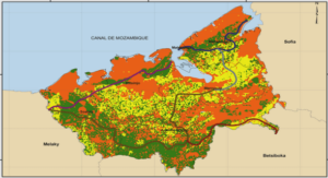
Field work was carried out in Montmorency forest, Quebec (47° 19′ N, 71° 9′ W), a 66 km boreal forest managed for timber and recreation. Balsam fir (Abies balsamea) and black spruce (Picea mariana) are the dominant tree-species, followed by white birch (Betula papyrifera), white spruce (Picea glauca) and aspen (Populus tremuloides) (Larouche 2005). In winter, temperature reaches -40°C and annual snow precipitation (November to April) generally exceeds 6 m (Environment Canada 2001). One of the management objectives of Montmorency forest is to recreate a stand mosaic that would normally reflect natural disturbances. To reach this goal, harvesting patches are separated into 3 groups (less than 10 ha, 10-30 ha, and 30-100 ha) and each group has the same total area. Moreover, harvests are spread out in time to obtain five main groups of stand ages: (1) regenerating (0-20 y), (2) young (21-40 y), (3) mature (41-60 y), (4) old-growth and (5) irregular (and mature or old-growth). Sylvicultural practices result in a very dense road network (2.91 km/km 2) across the area. No trapping or hunting is allowed in Montmorency forest, but outdoor activities (cross-country skiing and walking) are open to the public. All the required environmental data were provided by managers of Montmorency forest, who compile datasets from aerial photographs (scale 1:10 000), complete them with GPS data, and update them every year.
Snow-tracking
Spatial distribution of marten tracks was obtained by snow-tracking each winter from 2004 to 2008 inclusively. American martens are easy to track because they spend much of their time on the ground (Marshall 1951). Transects (length range: 200 m – 5000 m) were followed either on unplowed forestry roads or along straight N-S or E-W lines based on GPS, following multiples of 500 m on a Universal Transverse Mercator grid. Each marten path crossing a transect was recorded individually as a point occurrence of marten with a GPS receiver (Trimble GeoExplorer ®) (Figure 1). All tracks showing the mustelid twoprint track pattern, with two-print widths ranging from 8 – 13 cm were assumed to be marten tracks. Fisher (M. pennanti) is unusual in the area, so we assume that species identification was not an issue. Transects were not surveyed more than one time each year.
……….
Mémoire Online: Evaluation des couts de déplacement de la martre d’Amérique dans une sapinière boréale aménagée (910.79 KB) (Cours PDF)


